Our Bluffs & Bottoms: Treasure Trove of Native American History

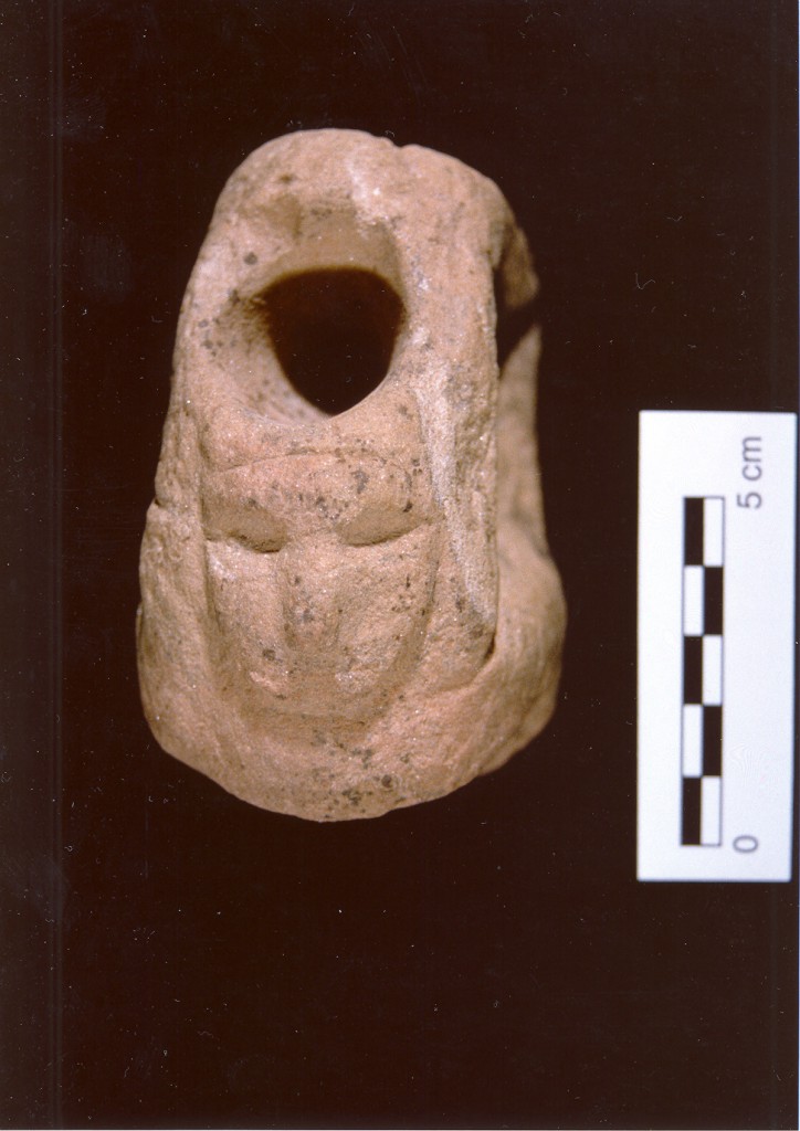
This carved stone pipe with facial image was found many years ago on a portion of the area of what later would become new town Valmeyer. Photo courtesy Dennis Knobloch.
With the founding of Clifftop in 2006 a concerted effort began to document and understand our bluff land corridor’s natural history and land use cultural history. Our earliest focus area was the Renault Grant.
The Renault Grant is a 10,000-acre area in the southwestern portion of Monroe County. In 1723, the king of France granted Philippe Renault, a French mining entrepreneur, the 15 square mile tract, which still bears his name. The Illinois Department of Natural Resources’ Fults Hill Prairie Nature Preserve and adjacent Kidd Lake State Natural Area lie almost dead-center in the grant, with 5,000 acres of floodplain stretching southwestward to the Mississippi, and 5,000 acres of upland forest and farm ground climbing to the northeast.
Merrill Prange, a prominent local leader who grew up in the grant area and is a passionate, long-term student of prehistoric Native American culture in the region, provided this analysis several years ago, which we reprint below:
American Indian sites are prevalent throughout the Mississippi River bottoms and the area encompassed by the Renault Grant. Between the bluff line and Stringtown Road there is scarcely a field without at least some scattered relics.
In the central part of the Grant, much of Stringtown Road follows the bank along the old river channel and slough. Thus the low-lying area south and west of Stringtown Road has little evidence of Indian culture.
South of Stringtown cross levee, the land is higher and shows cultural evidence nearly to the main levee. While Indians obviously lived and hunted west of the current main levee system, the accumulation of river silt has covered the entire area and made consistent discovery of cultural remains nearly impossible.
The main cultural affinities in the bottomland area are the Mississippian, Late Woodland, Middle Woodland and Archaic. Upland sites are primarily Archaic and Late Woodland.
Two Mississippian (circa 1200 AD) sites are located near the Village of Fults adjacent to the bluff line. The high limestone content of the soil near the bluff tends to preserve bone and shell. Shell beads, bone awls, mussel shell scrapers and similar non-lithic artifacts and debris, along with the usual chert, hardstone and hematite tools and weapons can be found. The limestone soil also protects pottery by retarding the acid reduction of the pottery’s crushed shell binding agent. Likewise, deer, turkey, and fish bones are preserved in the fire and garbage pits at the sites.

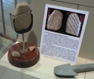
The carved stone tablet, found many years ago by Elizabeth Kassly on a farm south of Valmeyer, now is on display at the Cahokia Mounds Museum. Photo courtesy Dennis Knobloch.
One of the sites yields many limestone hoes and spades. Some are well made and exhibit good bit polish. The relative abundance of both limestone and Mill Creek chert spades supports the typical characterization of the Mississippians as an agricultural people.
Late Woodland (circa 500-1000 AD) sites are scattered across the entire bottomland area, especially near lakes. Some of the sites appear to be temporary or seasonal in nature and have a high concentration of one type relic, perhaps scrapers at one site or points at another. Many of the lake sites yield plummets in greater abundance that at sites further from the lakes. Pottery is scarcer that at Mississippian sites, probably due to cultural differences as well as high soil acid levels near the lakes.
A small Middle Woodland (circa 500 BC-500 AD) site lies near the Village of Fults. A large site or complex of sites lies west of Kidd Lake. The usual Adena based and Snyders points are found there. Pottery sherds with dentate stamping, nodded rims and other Middle Woodland hallmarks are also found. The soil at these sites is acidic with little limestone to neutralize it. Thus bone and shell are not found and pottery sherds are usually in poor condition. One of the hallmarks of Middle Woodland is the wide variety of cherts used. These sites yield points and tools in shades of brown, red, orange, yellow and green. Middle Woodland points also are in a greater variety of styles and exhibit better workmanship than Late Woodland relics.
Archaic (circa 6000-2000 BC) sites are scattered throughout the Grant and can be found in both bottomland and upland areas. Creek bottom hollows also tend to have Archaic sites. Most of these sites are small and have few relics except points and grooved axes. This may simply represent seasonal use of the sites; or it may be skewed by incomplete surveys and collections, particularly in upland areas. Archaic sites in the bottomlands tend to yield stemmed and base-notched points such as the Smith style. Upland sites tend to have corner-notched archaic bevel styles.

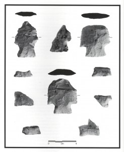
Arrowheads found during excavations preparatory to the relocation of Valmeyer. Archaeologists found the style to be unique and these are known as Valmeyer Points. Photo courtesy Dennis Knobloch.
There is a scarcity of Paleo Indian (prior to 6000 BC) material in the Grant. Occasional Dalton style points are found, but context leads one to believe that they are “found objects,” relics found by subsequent Indian cultures and kept as useful or symbolic items.
Little evidence of Early Woodland (2000-500 BC) culture has been found in the Grant. Historic contact pieces are found, but not in large concentrations. Given the proximity to Fort Chartres and the fact that the French colonial village of St. Phillip was located in the Grant, it seems that more should be found. Perhaps the sites are yet to be discovered and catalogued. Metal trade goods deteriorate relatively quickly in the bottomland soils.
Merrill Prange will present a Clifftop seminar on the archaeology of our area on Saturday, February 15th, at 1 PM, at the Monroe County Annex, 901 Illinois Ave., Waterloo. Dennis Knobloch will discuss Native American culture at Salt Lick Point, near Valmeyer. The seminar is free and open to the public. Reservations are required at (618) 458-4674 or clifftop@htc.net.
CLIFFTOP, a local nonprofit organization, is focused on preserving and protecting area bluff lands.
A version of this article appeared in the 7 February 2014 edition of the Monroe County Independent.
© 2014 all content rights reserved Clifftop NFP
Comments are currently closed.
