Time to Take a Hike and Absorb the Beautiful Local Autumn Views
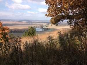
There is finally a chill in the air and the trees are hinting at what will be the beauty of their fall colors. Why travel to Maine or Michigan to view the vibrant oranges, reds and yellows when all we need do is motor around the highways and byways of our local counties. But don’t just drive by, get out and stretch your legs and get up close and personal with nature. Enjoy the peaceful surroundings of upland forests. Watch hawks and vultures soar below you and observe harvest time from on high as you reach bluff overlooks. Many who live in Monroe, Randolph and St. Clair counties are unaware that the area offers several hiking trails, each unique and beautiful in its own way.
Fults Hill Prairie Nature Preserve is owned by the Illinois Department of Natural Resources. It is located in southwest Monroe County along Bluff Road just a mile southeast of the small village of Fults. The address for location purposes is 2482 Bluff Road, Prairie du Rocher, IL. The 400+ acre preserve is home to many unusual plants and animals found in few other locations in Illinois and has a beautiful commanding view of the American Bottoms and Missouri bluffs to the west.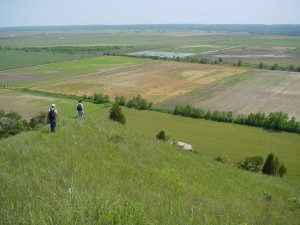
Kidd Lake Marsh in the bottoms to the west often has ducks, geese, white pelicans, and a variety of wading birds which can be enjoyed from the bluff-top, especially with the aid of a pair of binoculars. Hawks, vultures, and eagles are also commonly seen along the bluff edge or soaring over the bottoms.
The nature preserve has a 1.4 mile loop trail with a trailhead at a small rock parking lot just off Bluff Road on the bluff side. The trail is quite strenuous as it requires a very steep ascent from the parking lot to the top of the bluffs over 200 feet above. Two hundred and twenty-two steps start the south trail loop. That effort gets one about ½ the distance to the “top.” From there, the trail proceeds further skyward on a dirt path. There are several interesting overviews of the bottomlands in this section. Once at the top, one enters a rare native hill prairie natural community with native grasses and wildflowers in season.
From here, the trail is quite flat as it enters the woods and slowly bends northward and eventually west-ward before one leaves the woods and descends through a cascade of woodland, open rocky glades with cedars and prairie habitats, arriving at the bottom in the parking lot where the journey began. The trail can be taken in either direction, using the steps as either the first or last leg of the journey (most people prefer ascending the steps and descending on the dirt path). Estimated walking time is 30-90 minutes, depending on one’s physical abilities and curiosity. Take water. Sturdy shoes and a walking stick may be helpful. There are no developed facilities at this site except for the parking lot and stairs. The preserve closes at dusk. All trail walkers are required to stay on the trail and not disturb the animals and plants that are found in this special place.
White Rock Nature Preserve is a 306-acre tract, permanently protected by formal dedication with the Illinois Nature Preserves Commission. This preserve is owned by two local conservation non-profit organizations – Clifftop and Heartlands Conservancy (formerly Southwestern Illinois Resource Conservation and Development).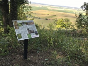
White Rock hosts extremely rare natural habitats. The White Rock tract is located within the Hill Prairie Corridor, a 25-mile stretch of ribbons and patches of hill prairie perched on top of the Mississippi River bluffs, looming above the flood plain. The Preserve contains 7 acres of rare loess hill prairie. White Rock Nature Preserve also is a part of a large, un-fragmented, upland forest, one of the largest contiguous blocks of woodlands in the state of Illinois.
White Rock Nature Preserve contains a 2-mile non-looping trail system through dense and healthy woodlands. The parking area for White Rock is approximately 2 miles south of original Valmeyer on Bluff Road. The address for location purposes is 6438 Bluff Road, Valmeyer, IL. Walk north along Bluff Road to the private roadway and then east on this roadway until you come to the trailhead. Steadily climb Early Venture Way Trail to Madeline’s Rest. Here you will be able to view the now closed entrance to what was the White Mine. Just to the right, as you face the mine opening, are interpretive signs and commemorative stones. In photos and text, the signs tell you a little about the history of the Preserve and the stones pay tribute to those that donated monetarily to Clifftop’s Stewardship Fund and in-kind to the development of White Rock’s infrastructure. The White Mine Trail rises rapidly from Madeline’s Rest and leads you to North Ridgetop Trail and South Ridgetop Trail, both of which terminate at hill prairie overlooks. Along the trails, enjoy more interpretive signage focusing on volunteers, prairies, glades and forest. Stone benches are a welcome break from hiking at numerous spots and offer spectacular valley views at two locations. Visitors are required to stay on the trails as hazardous areas may exist on the Preserve and to prevent damage to the fragile hill prairies and glades.
Stemler Cave Woods Nature Preserve is an old growth forest remnant set in the sinkhole plain between Millstadt and Columbia, Illinois. The site is listed on the Illinois Natural Areas Inventory because of the quality of the 120 acre oak-hickory forest. The woods became a dedicated Illinois nature preserve in 1986 and is owned and managed by the Illinois Department of Natural Resources. Stemler Cave Woods is the largest Illinois nature preserve in St. Clair County. In addition to the wooded communities, 75 acres of restored prairie in the preserve are in various stages of secondary succession.
There are numerous sinkholes in Stemler Cave Woods that create variations in topography and microclimates. Limestone exposures can be seen at the bottom of several sinkholes. The entire site is within the heart of the Stemler Cave recharge area, though the entrance to Stemler Cave is not located in the preserve. Original survey notes from the early 1800’s describe the plant community as a post oak woodland with a grassy understory. While there are still many large post oaks, the composition of the forest today includes many white, black and red oaks. Other more mesic plant species occupy the lower, moister portions of the sinkholes. An invasion of bush honeysuckle currently threatens the integrity of the preserve and visitors will likely see evidence of control efforts.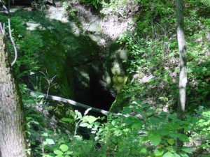
In 2006 the Homer F. Stemler Memorial Walking Trail was opened in Stemler Cave Woods. The trail offers over 5 miles of hiking with 12 interpretive points. Hiking level is easy to moderate. Visitors are required to stay on the trail. Pets are not permitted in the preserve. Access to the preserve and parking is available 2200 Stemler Road, Columbia, IL, 0.5 mile west of Triple Lakes Road.
Salt Lick Point Land and Water Reserve is a 600+ acre site that is owned by the Village of Valmeyer. It was granted approval for permanent protection by the Illinois Nature Preserves Commission in February, 2005. It is located in western Monroe County near the Rock City complex off Bluff Road just north of the original Village of Valmeyer. A large parking area at 1309 Limestone Lane accommodates hikers who begin at either Johnson Trail or Salt Lick Trail.
Three hiking trails have been constructed on the Reserve. They are open every day of
the year from dawn until dusk. All trails connect with one another and cover 5 miles in total. The original path, the 1.8 mile Salt Lick Trail, begins at the kiosk at the south end of the parking area and quickly heads up the bluffs on a very steep incline. The trail loops past hill prairies and glades and through centuries-old upland forests. At the apex, Salt Lick Point, you will find yourself 850+ feet above sea level, believed to be the highest spot in Monroe County. Continuing on Salt Lick trail, it will be all downhill from here, descending at Rock City and walking along Limestone Lane until you see the trail again beside the road. You will end at the kiosk where you began.
Johnson Trail starts at the kiosk at the north end of the parking area. This path is relatively flat and follows the base of the bluffs, meandering past limestone boulders the size of semi-trucks. In the spring the wildflowers that grow on the talus slopes are a spectacular sight to see. (Talus is a sloping mass of rocky fragments at the base of a cliff.) The cool air wafting down from the mine openings is a welcome relief when hiking on a hot day. Much of the trail is rocked, but parts of it can be muddy if there has been significant rain. When you come to the end of the 1.3 mile Johnson Trail, you have a choice—turn around and hike 1.3 miles back to the parking lot or walk up the Newman Trail to the south to join the Salt Lick Trail. If you choose to take the Newman Trail, be sure to make a sharp right turn and head uphill or you will find yourself in the re-located Village of Valmeyer on top of the bluffs.
Newman Trail begins at the kiosk near St. John United Church of Christ in new Valmeyer. Parking is available in the church’s parking lot. The entire trail is 1.9 miles long. This path rambles through the woods and along a creek bed—crossing the creek numerous times. When you reach the spot where Newman and Johnson Trails converge, you again have a choice—turn south (left) to continue on Newman Trail or make an about face and return to the kiosk where you began. Just remember, Newman Trail through the woods and creek is the only way back to your starting point. You do not want to end up at the parking area near Rock City because it would be a long walk back to your car.
Paul Wightman Subterranean Nature Preserve will soon be opened for passive public recreation activities. Clifftop began restoration of 400 acres to a native grass and flower-rich prairie/oak-hickory savannah system that will feature a 5 mile looping trail system that will wind past sinkhole ponds, forested areas and through the distinct karst-sinkhole plain that overlies Fogelpole Cave, Illinois’ largest and most biologically diverse cave system.
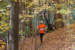
Salt Lick Point Land and Water Reserve is the home of the Monroe County YMCA-HTC Center Illinois Ozarks 10K Bluff Trail Run, which takes place the last Saturday of October each year. This year, Saturday, October 28 is the date for the 7th annual event. It is the only race of its kind in Monroe, Randolph or St. Clair counties. The trail run was developed in 2011, as a way to get the Y out into the local communities. It attracts runners from all over the Midwest, from Springfield, MO to Springfield, IL, and benefits two local non-profits: the Y and the Salt Lick Point Stewardship Committee. The course begins at the large pavilion, located on MAR Graphics Drive, in Borsch Memorial Park in the original Village of Valmeyer. In recent years a FREE children’s fun run has been added. Registration fee is $35 through October 14, and $40 thereafter. Register in person at the Monroe County YMCA-HTC Center, 9514 Caring Way, Columbia, IL, or online at Active.com. Race day registration is from 7:30 until 8:45 a.m. and the race begins promptly at 9:30 a.m. Enjoy homemade baked goods, post-race. For more information on the trail run, call the Y at 618-281-9622.
Clifftop, a local nonprofit organization, is focused on preserving and protecting area blufflands. A version of this article appeared in the October 6, 2017, edition of the Monroe County Independent.
Comments are currently closed.

